|
|
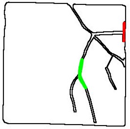
The image to the left shows the drainage system of the field from the previous web page. The red area is where the catch basin is. The green area shows where the picture of the grass waterway shown below is located. |
|
|
The image to the left shows the drainage system of the field from the previous web page. The red area is where the catch basin is. The green area shows where the picture of the grass waterway shown below is located. |
|
|
|
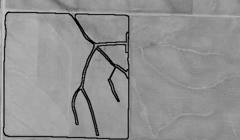
The picture above shows a 1991 aerial view of the watershed drainage area that runs off into the catch basin we dug out in 1999. |
|
|
|
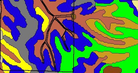
The image above shows soil slope. Brown is 11B, Tan is 99C2, Green is 9B, Blue is 9C2 & Yellow is 9D2. |
|
|
|
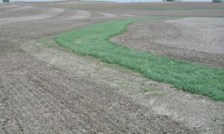
Above you see a picture of our waterway that takes on water only from our no-till field. This picture is in the same area as the green shaded area seen on the image at the top of this page. As you can see there are no gullies along side this waterway and in fact rainwater very seldom runs through this waterway. |
The images on the next page show just the opposite situation where water runs off from the tilled field next to it.